Tuesday, 21 September 2010

Up and Down the Dhauladhar Day 2

(...continued from Up and Down the Dhauladhar Day 1)
Rain fell in violent gusts all night. It had become quite cold. I was more or less comfortable in my foam sleeping bag, but Oli was shivering in her flimsy sack, and KP was positively suffering. He'd caught a cold and the previous day's sudden gain in altitude had not helped either. I gave him some analgesics to help ease his headache. At some point we managed to get some sleep.

Pic: Jagdish and shaggy dog wait in vain for the rain to abate. Picture taken by Bibek Bhattacharya

The day dawned with the weather in an even worse state. Everything was dank and gloomy and heavy rain was falling in a continuous sheet of loud grey. Outside, Triund was a sight of thick clouds being tossed about the ridge. Clearly there was no hope of making an early start for Laka. Gulab and Jagdish were already up and we were greeted with lovely cups of tea. While the others got up, I lazed around in my sleeping bag and dozed for a while before making my way to the kitchen. All our wet stuff was still wet so that was another thing to get used to. Jagdish's prognosis of the weather was not too good. He was skeptical of the rain stopping anytime soon and figured that the main nala that we'd have to cross between Laka and Lahesh would be in spate even if the weather did break later in the day.
We felt quite gloomy at this turn of events. Suppose we had to call off the trek? I couldn't bear thinking of that possibility, but we couldn't wait indefinitely at Triund either, waiting for the weather to turn and eating our way through our supplies.
It was pointless to sit around in the hut and mope. After a few biris smoked in companionable silence, Jagdish and Gulab wandered off to chat with other paharis. KP wandered off to get wet. He had gotten over the night's unease and that old familiar serenity had returned to his face. Oli was driven to distraction by his behaviour, but it seemed like a perfectly normal thing for him to do.
Every now and then the rain would slacken and I'd step out in the sloshy grass to take a few pictures of stormy Triund. And it was beautiful. Above us, nothing could be seen save the ghostly outlines of the Laka ridge, across which gossamer thin strips of cloud were being hurled by a strong East wind. The forest hut itself was protected from this onslaught by the main ridge of Triund. I climbed up this and was immediately buffeted by the wind as I struggled to keep my ears warm and camera working.

Pic: The Kangra Valley drowning in a sea of clouds. Picture taken by Bibek Bhattacharya

The Dhauladhar for all intents and purposes might not even have existed, so thick was that impenetrable curtain of clouds strung across its face. It occurred to me that since a brief glimpse of the Mon early the previous morning when we were rolling in to Dharamshala, I hadn't had a single view of the range. It was dispiriting, but my surroundings didn't allow me to dwell on this for too long,
Unless you go looking for it, its difficult to come across such an elemental scene of wild beauty. Facing the Laka ridge, to my west lay the steep path we had climbed to Triund. Far below, around the edge of a spur seemingly poised on the brink of a great plunge into the tangled construction of McLeodganj, hung the tiny Magic View Cafe. It kept wavering in and out of view as banks of clouds swallowed it up momentarily, and then, driven on by the wind, moved on leaving it visible again. High above that spur ran the wall-like broken ridge-top of Laka, dotted with weirdly contorted rhododendron and pine trees amidst extensive boulder gardens. To the east lay the thickly wooded valley of the Chauran nala, some 2,000 feet below, flowing down from under the south face of Mon. Looking down the mountainside into that mysterious shifting landscape of deep mist and thick vegetation and the occasional massive rocky outcrop was a thrill in itself.

Pic: Tendrils of cloud blow up the thickly wooded Chauran nala valley. Picture taken by Bibek Bhattacharya

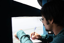
However it was impossible to stand for too long in that driving rain and I ducked back down under the protective curtain of the ridge-top. It was afternoon now, and though the light had improved, the weather remained as bad as ever. Oli, the eternal pragmatist, was well into her carefully rehearsed acclimatisation routine. After a hearty breakfast, she had settled down to write. I had tried keeping a journal as well, but I tired after one page, and the notepad was too soggy to write in anyway.
KP had gone off in the rain to meet Sunil, and the great, wet shaggy dog who'd been a refugee at our doorway had also tired of the inactivity and had wandered off. Leaving Oli to her writing, I went to look for KP. Little mirrors to the sky had formed on the path along the ridge and I made my way through the wet grass to Sunil's shack. KP was sitting outside the shop, rolling. The interior of the shop was occupied by an excitable gaggle of English voices discussing ephemera, so I stood outside under the flapping tarpaulin, watching the capricious clouds play on the ridge above. One of Sunil's many (apparently) ponies wandered by, dutifully grazing. Scattered groups of cows ate their way up and down the grassy slopes, resembling for all the world massive, mobile vacuum cleaners.
I stood there spacing for what seemed like a very long time. I was feeling very lethargic for some reason, so I made my way back to the hut, only to find Oli in the second stage of her steady acclimatisation process- she was lying in her sleeping bag and trying to feel warm, while reading a book on rock climbing, and trying out different knots with a wee length of rope. It felt pretty funny, hanging out with these two mountain lovers with their radically different approach to life on the heights.
Me, I'm the worrying kind, and I'd been worrying a fair bit since we'd started the day before. And one of my main worries was this matter of acclimatisation.Thanks to my two visits to Tunganath last year, I had successfully breached the 4000 m barrier, but then that was nowhere near as physically taxing as this would be. Although I'd only mildly felt the effects of altitude back then, I wanted to be absolutely sure this time around. Also, KP just had to acclimatise, as he'd never been anywhere higher than Laka, which is approximately 3,200 m. So when Oli instructed me to lie down and take a nap, I obediently crept into my sleeping bag. As I drifted off to sleep, I heard KP calling Oli out. Apparently it had stopped raining.
As soon as I'd fallen asleep, it seemed, I was rudely awakened. It was Oli of course, in that cheerfully steely voice of hers, instructing me to get up and come for a walk. It turned out that I'd been soundly asleep for a good 45 minutes or so. In that time, the weather had cleared somewhat. Most importantly, it wasn't raining. Outside, it was quite gorgeous. The Dhauladhar was still hidden. However, the overhanging cloak of clouds had receded a fair bit and was now draped over the head of the range. The snow fields, mini glaciers and the ice colouirs that can be seen pretty much all the year round had melted into forceful waterfalls and streams. Just the sheer number of waterfalls coming down from the all-pervading cloud was quite mind-boggling.
The cloud canopy stretched out from its tether on the Dhauladhar all the way to the distant Punjab plains, shimmering blue in the afternoon. Sandwiching us from below was a vast sea of blue clouds, filling up the entirety of the Kangra valley.

Pic: Oli, KP and Gulab deep in conversation. Picture taken by Bibek Bhattacharya

Oli suggested that we climb some way in the direction of Laka, and so we did, picking our way up the steep trail, trying our best to outflank the copious shit that that the cows had been depositing all day. The weather was so fine, that the three of us seriously considered making a dash for Lahesh. Even Gulab, who'd joined us for the ramble, made some noises  to that end.

Pic: Happy dogs keep watch on the Laka trail. Picture taken by Bibek Bhattacharya

Suddenly I looked up to see a grave furry face regarding us from a rocky outcrop. It was one of the Gaddi dogs- invariably called Tommy, or Johnny or Bhalu. We climbed up a bit higher till the point where the Triund spur united with its parent ridge of Laka. Oli bounded off ahead. She was obviously feeling this need to keep moving, but I, as usual, stopped to take yet another view of my surroundings. Closer now to the main range, I could get a good look at the giant flanks of the Dhauladhar. The mountainside was a jumble of massive rock falls and boulder fields. The rain-fed Chauran nala was gurgling down in the forested ravine below me. To the easte, running parallel to my Triund spur, were others much like it. Each of these ultimately lead up to the various passes that punctuate the main range. What fun it would be, I thought, to wander about these spurs, traversing the breadth of the range.
In fact, I'd been seriously thinking of turning our little project into a treeline trek, going all over the Southern face of the Dhauladhar. But that route just didn't possess the joy of crossing two passes, even if it would be a worthwhile way to explore the land. But I still held some hope that the weather and Indrahar would relent.
KP and Gulab were sitting a little way below me deep in conversation, brilliantly silhouetted by the blue cloud-sea that was the Kangra valley.

Pic: The Dhauladhar, smoking hard. Picture taken by Bibek Bhattacharya

Oli returned in a bit, looking as energetic as ever. Her exuberance is quite infectious, so we decided to climb up to the Tibetan prayer flags festooned at a point on top of the ridge that marks the area where the Triund spur merges with the Laka ridge. We'd gone a little way when we saw two figures bounding down the Laka track. They were an American hiker and his Gaddi guide. A shouted conversation with the guide ensued. They were returning from Lahesh and according to him, the trail was perfectly safe as of now. The nala that had so haunted our plans was in spate, but was crossable. According to him, we could still try for Lahesh.
This further added to Oli's restlessness and she rushed down to Triund to discuss this with Jagdish. He'd been full of doom the entire day, not trusting the weather- or was it our capability? Anyway, since it was getting on to 4 pm, and we weren't exactly travelling light, I thought it would be better to spend another night here and start tomorrow morning despite the weather.
It was a lovely afternoon to be at Triund, so me and KP sat around, chatted in fits and starts and took some pictures. Then we started down at an easy pace, while KP filled me in on Sunil's fifty horses and the envy this caused among the other paharis. A couple of years ago, when KP had first come to McLeodganj, some of his Gaddi friends had brought him up to Triund in a direct line that climbed the 3,000 feet from Bhagsu along the entire length of the Triund spur. Ridiculously steep in places, it had both enchanted and scared the living daylights out of KP. We decided to check it out.
We met Oli as she was coming up to us. She'd managed to get Jagdish to promise that we'd make an attempt to get to Lahesh the next morning. She seemed a lot calmer as a result. That particular load off our heads, we truly enjoyed ourselves for the next couple of hours, walking around on the beautiful rain soaked green turf of Triund while the world below us seemed to be drowning in an ocean of blue. Oli got me to climb some rocks too, and despite misgivings, I did fine, aided a good deal by my veteran boots which, after some eleven years of rough use, still retained a fantastic grip. KP, extremely disinterested in all this exertion, took to impersonating a human rocky outcrop. Every now and then I would see him standing on some rock, dramatically framed by the seething blue clouds, quietly contemplating the void.

Pic: KP contemplates the void. Picture by Bibek Bhattacharya

The wind was picking up, gently blowing tendrils of clouds from the layer below us to the one above. We sat in perfect silence, each of us lost in our own thoughts.
Before our eyes, the Mon began to do a striptease. At first only a ghostly outline, the high winds near its summit slowly blew away the clouds obscuring it from view. Presently the peak and a large portion of the summit ridge slowly revealed itself in all its stark, brooding glory.
Owing to the time of year, the snow-less Dhauladhar resembled a fortress made of tiers and tiers of black rock. Not for the last time, the scene reminded me of something out of Lord of the Rings. Indrahar was a tiny notch to the left of the peak, one that you'd easily miss if you weren't looking for it.

Pic: The Mon finally reveals itself; Indrahar Pass is the notch to the peak's left. Picture by Bibek Bhattacharya 

From here the south face looked so sheer and perpendicular that the thought of actually being on it made me involuntarily shiver a bit. With the weather we were having, this looked like serious business. But instead of being freaked out, I felt a desperate urge to be on top of the damn thing. If I could've started out right then, I would have.
Meanwhile, Triund was having a regular day. After the day's 'Garbage In Garbage Out' the cows had retired. There was one standing motionless while a tourist filmed it. Young Johnson, a sweet Gaddi dog who'd been accompanying us all afternoon was trying to turf out the cow by barking furiously. The tea shops were buzzing with talk, laughter and endless cups of tea. Now that the day trippers had returned to McLeodganj, there was a fair degree of fellow feeling among those who'd stayed back.

Pic: Evening clouds climb ominously, with the Pong reservoir in the background. Picture by Bibek Bhattacharya

It was getting cold and windy, so we went back to our little hut. I was getting pretty fond of this little place, it felt like home. Gulab got some tea going while KP and Oli pottered about doing nothing in particular. I sat on a rock next to a blasted tree and spaced, looking out to the far distance where the massively swollen Pong reservoir was glittering blue. Then the thick clouds covering Kangra slowly started climbing up, ominously obliterating everything in their path. Spooky. Another evening of desultory conversation, dinner and early to bed. We would make an attempt to get to Lahesh cave the next day.
To be continued...

Tuesday, 31 August 2010

Up and Down the Dhauladhar Day 1

Winding down the twisting roads through the highlands of the Kangra valley, the sight that greets you about an hour before you hit Kangra town is breathtaking. Up north, the gentle swell of the rolling uplands suddenly come up smack against a high jagged wall that dominates the horizon. And it goes on forever, running in a long unbroken stretch from the east to the west, like a mythical barrier guarding some forbidden paradise.
At an average height of 14,000 feet, the Dhauladhar range isn’t as big as the other Himalayan sub-ranges of Himachal Pradesh, but it is certainly one of the most dramatic. Rising up some 12,000 feet from valley floor to ridge-top, this serrated range looms over everything, clad in a thick coat of snow and ice that only relents in the monsoon months.
It’s a sight that has enticed me for many a year, due to my frequent trips to McLeodganj, which has to be one of the nicest hill-towns within reach from Delhi. Hiking up to Triund, a grassy meadow high up on a subsidiary spur of the main range is something that everyone does, and a great hike though it is, its just the approach march to a great trek that leads you over the Dhauladhar range to the Ravi river valley in the Chamba district. Triund is where my fascination with this trek was born some two years ago, and it was only this year that I had the chance of going there.
Monsoon is hardly the best time to go for this trek, and with the heavier than normal rains this year, we were told roundly by all comers that it was madness. However, two things were in my favour. My guides were of local Gaddi stock, the dominant community of much of the Chamba and Kangra region. Mostly traditional shepherds, they know every valley and pass around the Dhauladhar and Mani Mahesh ranges, which form their old homeland of Gadderan. The second was that one of my companions, Oli, was a trained mountaineer who had the experience of quite a few big expeditions. Brought together, these two factors played a big part in assuaging any fears I might have had.
As we limbered into McLeodganj on a Monday morning, the signs were not encouraging. The Dhauladhar was cloaked in thick clouds and it was raining hard. In a way, it was better this way- once you’re soaked through, you pretty soon get used to the idea. The first thing to do was to meet Jagdish and Gulab, our companions for the next 10 days, so we quickly boarded an auto to Bhagsu, which lies a couple of kilometres above McLeodganj.
Pic: Gulab (left) and Jagdish (right). Picture taken by Amrita Dhar
Jagdish, a stocky, solid man with a shy, retiring nature and a faraway look in his eyes had been guiding in the area since 1979. His compatriot Gulab was a wiry 26-year-old father of two with ankles of steel; an irresistible charmer and an ardent believer in the powers of direttissimo- the most direct route over any obstacle. Although we had planned to stay an entire day at McLeodganj and re-pack our sacks and shop for fresh vegetables and other foodstuffs, Jagdish was of the opinion that in weather like this, we shouldn’t waste any time and make for Triund immediately, some 10 km and around 3,000 feet above us. We scattered in different directions for a last burst of provision shopping. A breakfast, numerous cups of tea and ruthless repacking later- where we discarded most of our extra clothes and other luxuries- we were off climbing steep country tracks through the resin-scented pine forest of Dharamkot. 
Pic: Walking up through the pine forests of Dharamkot. Picture taken by Bibek Bhattacharya
Since we could only start off at noon, the high sun had slowed the rain to a steady drizzle, although a thick ceiling of clouds still hung over the range like a shroud. 
Pic: Runaway monsoon vegetation on the Triund trail. Picture taken by Amrita Dhar
The path to Triund is one I’m very well acquainted with, but it was still a pleasure to walk up this steep trail, heavily laden though we were with 10-12 kg rucksacks and stopping occasionally for breath. To get to Triund, you climb up the Dharamkot spur above Bhagsu and then traverse the Laka ridge onto the Triund ridge, rising steadily all the time. The southern slopes of the Dhauladhar are beautiful, but the mist and rain of the monsoon add just that right hint of mystery and elusiveness that makes the surroundings seem positively magical. 
Picture taken by Amrita Dhar
Although I was a bit worried about weather conditions on the pass, I was certain that this approach march would be the most exhausting one, as our bodies got used to the steep gradient and the extra weight. We met familiar faces along the way. Anil owned a tea- shop aptly titled ‘Magic View CafĂ©’- though there was hardly any view to speak of right then- and welcomed me and KP (my other companion and another McLeodganj veteran) although he was a bit downcast. One of his cows had fallen awkwardly and had broken her back. A couple of cups of tea, a quick goodbye and we carried on through the deepening mist and intermittent rain up the final steep1000 feet to Triund. The track wound up between massive boulders and landslide zones, around and through carcasses of massive pines and rhododendron trees. 
Pic: KP trudges up through the rain. Picture taken by Bibek Bhattacharya
Occasionally we'd have to jump over little rivulets, or wade through some mushy ground. I really struggled the final kilometre, stumbling up through the oppressive mist, struggling with the weight on my back and sweating profusely. Gulab, predictably, had reached a good while ago and came down to relieve me of my rucksack as I huffed and puffed my way up the final rise onto the green alp of Triund. The tremendous backdrop of the rocky south face of Mon peak was invisible in the threatening clouds, but as always, the soft springy turf of Triund gladdened my heart. The four tea shops that are a fixture here were busy with day-trippers and foreign tourists, though, thanks to the rain, the crowds that normally ascend everyday to Triund were absent.
All I could think of was my intense sugar craving; I was lusting after sweet biscuits, anything really, to satisfy my sweet tooth and get some much needed energy. So while KP trudged off in the rain to say hi to Sunil, who owned the tea-shop on the southern end of the ridge, and Oli went off with Gulab to secure the old forest hut and get some tea going, I rushed into the nearest tea-shop and promptly devoured a packet of Hide’n’Seek. Feeling human again, I sloshed my way to the hut. The Forest department runs a new bungalow on the saddle of the ridge which one needs to book from Dharamshala. However, just behind it is an old British-built log hut which is open for any happy camper that chooses to pass through. That's where we camped for the day, glad to be finally dry, sipping hot mugs of tea around a smoky hearth-fire, while Gulab and Jagdish got busy preparing an early dinner.                                           
Thick clouds were passing over the ridge as daylight faded and it was raining incessantly. Below us, the Kangra valley was overrun with heavy blue clouds, though far away out in the valley, I could make out sundry Dhauladhar rivers like the Bhated nala making their way to the Beas. Above us was an unmoving blanket of dark pregnant clouds. 
                                               
Pic: The rain lashed Triund ridge. Picture taken by Bibek Bhattacharya
Our plan was to leave the next morning for Lahesh cave on the main range if the weather cleared for a bit. There were, of course, many factors that we had to take into consideration. The first was acclimatization. If we hoped to do the Indrahar crossing the day after, then it was of paramount importance that we acclimatised as quickly as possible. At a height of 4350 m, the pass was one of the highest in this pass-riddled range, and to try and cross this very exposed ridge in this treacherous weather without acclimatizing was unthinkable. The second most important factor was the weather itself. We could expect a lot of boulder scrambles over the next two days and to do so in the rain wouldn’t be a good idea. So we had to move whenever the rains let off a bit. Accounting for this, we had kept a couple of days in hand for unforeseen breaks, but now that we were on the move, I didn’t really wish to rest. We turned in quite early after a hearty meal of khichdi and prayed for a clear dawn.

To be continued...

Wednesday, 2 June 2010

Roerich's Himalaya

The National Gallery of Modern Art in New Delhi is a place I love going to, although I must also say that I don't visit it as often as I should. One of India's few- and the best by a long shot- state-owned art galleries, NGMA's collection is a medium sized but fascinating one. Leaving aside the Gallery's collection of contemporary Indian art- which is sizable- its the permanent exhibits of the Bengal School of Art and those of other artists related to it like Amrita Sher-Gil, that keep drawing me back. There's a degree of inventiveness and boldness to the work of this large body of artists that I find lacking in most of our contemporaries.
The collection that I never miss, however, is that of the Russian artist-philosopher-mystic-anthropologist-archaeologist-traveller Nicholas Roerich. His mountain paintings are unmatched in their breadth, depth and scope. Its almost like stepping into an alternate universe where mountains perform the roles of deity, habitat, scenery and a spiritual challenge all at once.

 Pic: Kuluta 1936 (courtesy www.tanais.info)

And that's just on one level. At another, they are masterful studies in light and tone.

                                
 Pic: To Kailas, Lahul, 1932 (courtesy www.tanais.info)

Although Roerich has as distinct a style as any painter, no two mountain studies are similar, even when he's painting the same mountain from essentially the same vantage point, as these superlative studies of Kanchendzonga show.

 Pic: Kanchendzongka 1936 (courtesy www.tanais.info)

 Pic: Kanchendzongka 1944 (courtesy www.tanais.info)

In no other artist's depiction of mountains have I seen geography consistently appearing as fully fledged characters. To look at a painting like Nanda Devi is to drown in that mountain's divinity, sheer physical beauty, as well as the immense psychic power that she wields on the people who live in her shadow.

 Pic: Nanda Devi 1944 (courtesy www.tanais.info)    

The 6 prints I have from NGMA are part of Roerich's Himalayas series, which he contributed to sporadically over a period of roughly twenty years. This mammoth series alone has over 2,000 paintings- a testimony to Roerich's prolific output. All, this master painter created over 7,000 paintings over many other series, which is staggering by any standards. However, the quality of his work never suffered.

 Pic: Krishna (Spring in Kulu) 1929 (courtesy www.tanais.info)


 Pic: Sunset 1931 (courtesy www.tanais.info)

Roerich's interest in the range took many forms, each one mirroring one of his many pursuits. As a dedicated chronicler of culture both indigenous and shared, the plethora of disparate cultures and yet close cultural borrowings on both sides of the Himalayan crest fascinated him. He wrote,
"The Himalayas, in their full might, cross these uplands; behind them, rises the Kailasa, and still farther, Karakorum and the mountain kingdom crowned in the north by the Kuen Lun. Here also are the roads to the sacred Manasarowar: here are the most ancient paths of the sacred pilgrimage. In this region is also the Lake of the Nagas, and the lake Revalsar, the abode of Padma Sambhava. Here also are the caves of the Arhats, and the great abode of Siva, the Amarnath Caves; here are hot springs; here are the 360 local deities, the number of which testifies how essential are these very sites of the accumulation of human thought through many ages."
The Himalaya's greatest hold on Roerich, though, was in matters of the spirit. On completing his epic 1923-1928 expedition through Sikkim, Tibet, Kashmir, Ladakh, Siberia, Altai and Mongolia to collect and preserve cultural texts, he was so drawn to the great range that he set up both his home and his Himalayan Research Institute in Naggar in the Kulu valley. He considered the Himalaya a  symbol of humanity's inherent hunger for transcendence through beauty and knowledge, a common cultural thread that he'd observed in his wide ranging travels. He called the range the "Treasure House of the Spirit."
His paintings do justice to that claim, like his study of the Chandrabhaga river or the unforgettable Ice Sphinx.

 Pic: Chandrabhaga 1932 (courtesy www.tanais.info)

 Pic: Ice Sphinx 1938 (courtesy www.tanais.info)


People appear only at the margins of his mountain canvases, but they're an important part of the whole, both grounding the soaring majesty of the backdrop as well as well as providing context for the allusive stories that he tells through his canvases.

 Pic: Remember 1934 (courtesy www.tanais.info)


Some of them bear strong influences of his earlier Iconographic art- tropes and symbolism that he adapts marvelously for his latter paintings.

 Pic: The Messenger, 1946 (courtesy www.tanais.info)


Over the years, you can see his style change. From real, tangible geography, his paintings seem to turn inwards, as he washes the paintings more, giving more of a hint of indistinctness and interpretive haze. They become even more metaphorical, but even then they're never anything other than mountains, because that's all they need to be in Roerich's paintings. It reminds me of the Zen Buddhist saying, "You look at the Void, and the Void looks back at you."

 Pic: The Himalayas The Earth Yetis 1947 (courtesy www.tanais.info)


Even without delving too deep in his symbolism, its impossible not to come away from this huge and varied body of art without a profound sense of peace.

 Pic: Castle in Ladakh 1933 (courtesy www.tanais.info)


And to think he did all this, as well as create the Roerich's Pact, and the theatrical designs for Stravinsky's Rite of Spring!

Friday, 28 May 2010

Moving Up

It all started with a missed bus. After some two weeks of deliberating, on February 28 2009,  me and Priyo were finally out at the Anand Vihar ISBT, hoping to get one of the frequent- so we were told- buses to Almora. So we arrive bright and chirpy at 6 in the morning only to find that the bus had left at 5:45- and that there would be no other bus till the evening. While we were casting about at this unfortunate turn of events, the conductor of the Delhi-Nainital bus threw us a lifeline. Why not take the Nainital bus to Haldwani, and then take a bus to Almora in the afternoon? As the Nainital bus was just about to leave, we quickly boarded without any further invitation.
                                           
Pic: Priyo, my travelling companion (Bibek Bhattacharya)

Delhi to Haldwani, some 120 km, is a dead bore of a drive as the majority of that distance involves travelling through northern UP, which is nobody's idea of a beautiful place. 
Well, in between the horrid towns there is enough to see- like lush green fields of winter crops waiting to be harvested- but mostly your senses are overburdened with massive political posters of all hue and ideology asking for your precious vote.

                                        
Pic: The sprawl of Moradabad is symptomatic of northern UP in general (courtesy Wikipedia)

Its interesting to see the scenery change gradually. The flat green lands of the Gangetic plain gradually change into the upper Terai forests once you cross the border into Uttarakhand. I must say though, that 'developement' makes the Gangetic plain pretty difficult to spot. When we did cross the Ganga over an ancient rickety bridge chock-a-block full of traffic, all I could think of was murder as all I could see was hideous over-construction choking the river. A few hours of somnambulist travel through the dust choked landscape the bus arrived at Moradabad. It got intensely crowded in Moradabad, almost like a cliche of people jostling with chicken, and for a while it turned into a inter-city public transport.
Things started getting interesting after we crossed over into Uttarakhand at Rampur. Between Rampur and Haldwani, lies a long stretch of beautiful forests. This is a common enough feature throughout the Terai region, which stretches all the way from Himachal Pradesh, across Nepal and upper West Bengal and Sikkim

                                     
Pic: The Terai valley near Rishikesh (Bibek Bhattacharya)

Just before the Himalayan foothills begin, you're bound to pass through an upper Terai jungle of some shape or size. The entire length is criss-crossed by a number of Himalayan rivers passing through to join the two main ones, Ganga and Yamuna. Sadly, this beautiful catchment area of the subcontinent is disappearing under the combined weight of human habitat and industry. 
Soon it was around two in the afternoon and I was getting antsy as there didn't seem to be any sign of a hillock, let alone mountains. Then suddenly, hey presto, green, rolling foothills looming gently on the horizon! We were finally at Haldwani.

                                    
Pic: Haldwani (Bibek Bhattacharya)

Haldwani is one of those entry-points into the mountains, like Dehradun and Rishikesh in the west, and Siliguri in the east, which are major transport hubs, as roads fan out from these places to other towns deeper in the hills. 
Priyo happily lit a biri to celebrate our successful journey to the half-way point while I went to the ticket counter to find a bus to Almora. Here the helpful Nainital conductor turned out to be a pretty clueless bloke. He insisted that Binsar is closer from Ranikhet than from Almora, and that we should try for a bus to Ranikhet instead. I consulted  my handy Eicher road map (as well as the Nest & Wings state map) and found this claim impossible to believe. In this we were proved quite right. Everyone we asked at the bus stop was unanimous that Binsar is near Almora. It was only later that I found out that there is indeed another Binsar near Ranikhet, called Binsar Mahadev, but by no stretch is it the Binsar.
Tragedy threatened for the second time in the day when we were informed by an apologetic man in the Enquiry booth that the sole bus for Almora from Haldwani had left at 2:30 pm, and here we were, standing in the middle of a chaotic bus depot at 3 pm, wondering what to do. What we didn't know at the time was that the man was referring to just State Transport buses.
Some stray voices in the seething chaos helpfully informed us that the Delhi-Almora bus that we had missed in the morning had gotten delayed and had yet to reach Haldwani. So we rushed to the main road waiting for the  mythic bus to appear, hoping against hope that we hadn't missed it a second time. We were desperate to keep moving, reach at least Almora by the end of day. A cry went up and  sure enough, there it was, disgorging passengers. Feeling quite happy with ourselves, we parked our relieved haunches on it and breathed a sigh of relief.
Apart from the local Kumaonis, very few people actually travel the full distance from Delhi to Almora or from Delhi to Nainital by the morning bus. This suited us just fine, as the this one was just about half full with local families travelling between towns.
Beyond Kathgodam- this is as far as the train line gets in the Kumaon- the road started climbing up the foot hills and I started grinning stupidly even as my spine started tingling with anticipation. My mind was screaming "ALTITUDE!" in big capital letters. The next couple of hours passed in a blur, with me hanging out of the bus window taking pictures, or just looking at the gorgeous views. Even the humblest of shacks in the Himalaya are transformed by the majestic backdrop. There were some 20 different places along the way which I thought would be perfect for my fantasy house in the hills. A happy dream.


Pic: Winding up the road to Almora (Bibek Bhattacharya)

Winding up the deep, labyrinthine gorge of the Kosi, we finally started climbing the Almora ridge around 6, exactly 12 hours since we'd set out. The sun was setting behind some high ridges across the valley, and a dramatic sickle moon was starting its progress across the heavens. By the time the bus stopped at the Almora bus depot, it was already dark and we were debating whether to stay the night in Almora or try and get into Binsar. Priyo and I were both of the view that we should end the epic journey in Binsar itself, rather than waste the night at Almora. After fighting off a bunch of well-intentioned cab drivers, we got into the car of one Ramesh, who agreed to take us up for Rs 700, the standard rate. 

Thursday, 27 May 2010

A Remarkable Man

Here's something I came across on Project Gutenberg. This is a book published in 1899 by the English adventurer/painter/traveller/raconteur called Arnold Henry Savage Landor- an account of his somewhat alarming, but extremely interesting travels and travails in Southern Tibet in 1897 called In the Forbidden Land.


Pic: The Tibetan weather and Landor's hardships leave their mark (early 1897 and late 1897)
Taking place shortly after Francis Younghusband's legendary overland spying trip and preceding the Younghusband-led invasion of Tibet, this is a fascinating account. Two things I'd like to share here, the first one a painting of the classic lower Eastern Kumaon view of the Himalayan crest, with the famous contours of Nanda Devi, Trishul and Nanda Kot rearing up like a feverish dream. The funny thing is, the peaks really do look like this in real life.

Pic: Landor's painting of the Kumaoni peaks of Nanda Ghunti, Trishul, Nanda Devi and Nanda Kot 
The second thing is the author's map of his travels, which is fascinating in the number of Indo-Tibetan passes it maps, as well as routes and natural features stretching parallel to the Tibetan-Nepalese border all the way to Everest.


Pic: Landor's map of his travels in Southern Tibet
He was working under the aegis of the Royal Geographical Society- definitely as a surveyor, maybe as a spy- and made many important discoveries on this trip, which included finding the sources of the Indus and the Tsang Po (Bramhaputra) rivers.

In approaching Tibet, Landor takes the traditional trading and pilgrim route to Tibet from Kumaon, which lies along the Kali river- it forms the natural boundary between India and Nepal- following the route from Nainital, via Almora and Pithoragarh to Garbyang on the Indo-Tibetan border, which is crossed via the high Lipu-Lekh Pass.

Pic: Two views of Lipu-Lekh pass; (above) the southern face, India and (below) the northern face, Tibet
Near here the Kali river forms a fearsome, rain-lashed and dark gorge, which is at its worst beyond the village of Nirpani. I'd first read about it in Umaprasad Mukherjee's 1934 account of his trek to Kailash-Mansarovar. His description of the gorge is hair raising and it feels great to come across Landor's photographs and paintings of this fearsome place.


Pic: Landor's photograph and painting of the fearsome Kali river gorge at Nirpani
Then there is a striking painting of Taklakot, the first fortified village on the Tibetan side of the pass, where the local Tibetan border and tax officials resided.

Pic: Landor's painting of Taklakot fort in Tibet
There's plenty more, including two very atmospheric renditions of of the twin holy lakes of Hindus and Tibetans- Rakhshas Tal (Langa Tso) and Mansarovar (Mapham Yutso). In the background of the Rakhshas Tal painting, you can see the Holy of Holies Mt Kailash (Gang Rinpoche) rising like a mystical lightning rod.

Pic: Mansarovar lake (above) and Rakhshas Tal with Mt Kailash in the background (below)
Landor was a fascinating man. Grandson of a British poet settled in Florence, he painted world leaders- from US President Benjamin Harrison to Czar Nicholas- and regularly hobnobbed with many more, including Queen Victoria and Franklin Roosevelt.

In the main, he was an inveterate traveller from 1889 to 1915, exploring the remaining blank frontiers of Western knowledge in Tibet, Japan, China, Nepal, Abyssinia, Philippines, Persia and the Amazon river- painting and writing lively travelogues. What's more, he did the overland route from Holland to Calcutta through Persia with a posse of cats. One of them suffocated in the heat of a train carriage in India, and he never quite forgave the country for it.

Pic: Landor with his cats Kerman and Zeris who accompanied him on his overland Persian trip
Almost certainly an agent of Empire in the Great Game, he was a success both on the trail and on the printed page, his best-selling books getting him lucrative lecture tours all over the world, and further travel opportunities, which suited this raconteur just fine. He seems to me that quintessential roving Englishman of the Empire, a witness to history.


IndiBlogger - The Indian Blogger Community

Monday, 24 May 2010

Map Woes Part 4

(...continued from Map Woes Part 3)

A recent visit to the Survey of India map sales office in Delhi was most frustrating. The people there were extremely reluctant to show me any maps without me first telling them the exact sheet number- they probably even need the latitude and longitude- and even then could only give me some large but pretty useless trekking maps of the Gangotri, Badrinath, and Shimla hills regions.

Pic: The impressive looking but ultimately disappointing trekking map from SOI (Bibek Bhattacharya)

They were careworn and mothballed, and the contour maps were kept firmly out of sight. I had made the mistake of going there without the sheet names and they effectively used it against me. And of course there’s that eternal suspicion. Just who is this person, they think. Why does he want topographical maps of border areas?

I had to settle for the trekking maps. Next time I go, I’ll take a sheet of paper with ALL the sheet names I can think of, and then some. And this time, if they demur, I will HAVE to do the unethical thing and wave my press card at them!

But then, a few weeks ago, I found this! I’d heard of it before, but I had no clue that it was freely available.

These amazingly detailed topographical maps are the legendary Series U502, made by the US Army Map Service for, yes the US Army, back in 1955. That makes them 55 years old, but boy are they out of this world. These sheets are the real thing- at least in the absence of SOI sheets. And the sheer scope of it is massive too, covering the entire subcontinent, including India, Pakistan, East Pakistan- ah the period piece ring of that- and Ceylon.

From what little of this vast map I’ve seen, most of the Himalayan regions seem to be pretty accurately mapped, at least after checking them against the others. And I can’t begin to describe the joys of learning the names of the many unforgettable places that I’ve seen in the mountains, and all that I’m yet to see. Entire ridge systems, rivers, towns have their names. Now these names might have gone out of use since all those years ago, but many of these I’ve managed to verify. The trend seems to be that of pretty accurate nomenclature.

Pic: The Dehradun Sheet of the AMS Series U502 (Bibek Bhattacharya)

The maps trip up in some places. For example, in the 'Simla' (sic) sheet, there’s a blank spot beyond the Pin Parvati pass where Spiti should be. It could be that the region had not been surveyed at the time. Then there are problems with the deeply contentious Indo-Chinese international border north of Gangotri. According to these maps, the entire Mana Gad (Gad is Garhwali for river) valley and its tributaries belong to China, although a glance through Kapadia’s Across Peaks and Passes in Garhwal gives us the real picture. At the end of the day there is no substitute for actually visiting these places.


Pic: Compare the section of the Chini sheet with Kapadia's map for the Mana Gad area in upper Central Garhwal. (Bibek Bhattacharya)

However, it must be said that where unsure, the Series U502 mentions it. They even have a handy 'Reliability Diagram' to the right of the map, where they rate the available information in that particular sheet from 'Good' to 'Fair' to 'Poor', and even list out the dates when the ground was surveyed. The oldest survey on the 'Chini' sheet, for example, are Medium Scale Topographical Maps from 1905!

Anyway, I’m completely in love. Oh, and finally, to end where I began, I now know the names of the eminences you see when you stand atop Chandrashila on a clear October day. It might be a meager victory, but to me that’s momentous!

And so, my map woes are at an end- at least until I renew the saga of SOI Topographical maps.


IndiBlogger - The Indian Blogger Community