The Eric Shipton Anthology possessed his superlative book Nanda Devi, which had a reasonably good map (which was great to get my bearings) of the Nanda Devi-Bhyundar- Joshimath-Badrinath-Madhmaheshwar area; basically central Garhwal.
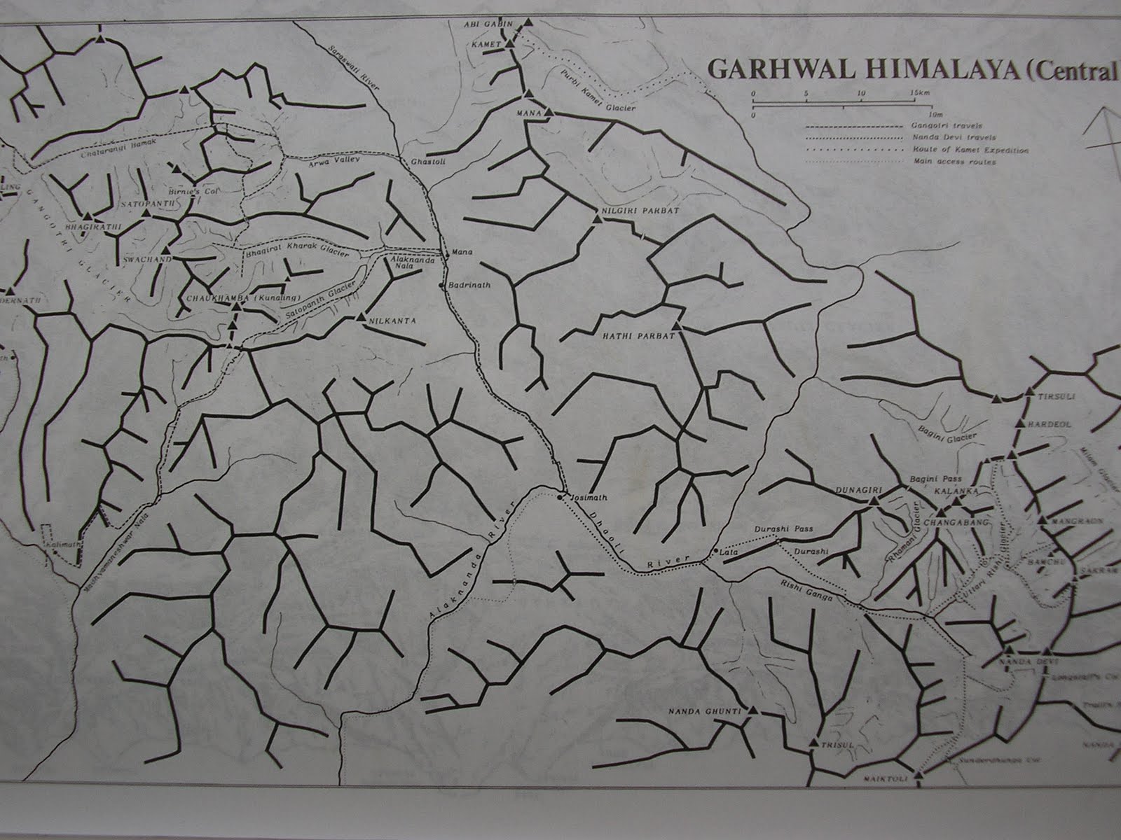
Pic: Central Garhwal Himalaya from Shipton's Nanda Devi (Bibek Bhattacharya)
An infinitely better plotted set of maps soon emerged out of mountaineer and photographer Kekoo Naoroji’s book of photo essays Himalayan Vignettes. It also had a very good set of maps of Western Sikkim, the area around Kanchenjungha and Nepal Gap glacier. What’s more, the book also included sizable chunks of lower Garhwal.


Pic: Map of the Bhyunder-Kamet region in Central Garhwal from Smythe's Valley of Flowers (Bibek Bhattacharya)
The problem with this was age. It was written in 1938- he made the journey in 1937- and that area was only in the process of being properly surveyed, so names of lesser peaks, glaciers and villages wasn’t exactly fixed. But it felt great to compare maps and accounts of these early writers- for a profoundly Indian point of view of the Uttarakhand Himalaya in that era, see Umaprasad Mukherjee's travelogues.

But I longed to get my hands on some serious maps of the Western Himalaya. Being quite hidebound as well as anal in my pursuits, I especially looked out for maps of Uttarakhand, as this was the region I wanted to explore first.

4 comments:
This is like reading The Two Towers... what happens next? Does our hero win through? Does he find the magic map of his dreams? What of the love interest? Does the dragon turn out to be a blind old bat who becomes Faithful Fido?
Patience, the truth will out...
hidebound AND anal.
i really like the self-reflexive tone of this post:))
just kidding. thanks for all this info in one place. and thanks for becoming an encyclopedia on the subject, makes my travelling SO much easier...
I try Debo, I try
Post a Comment